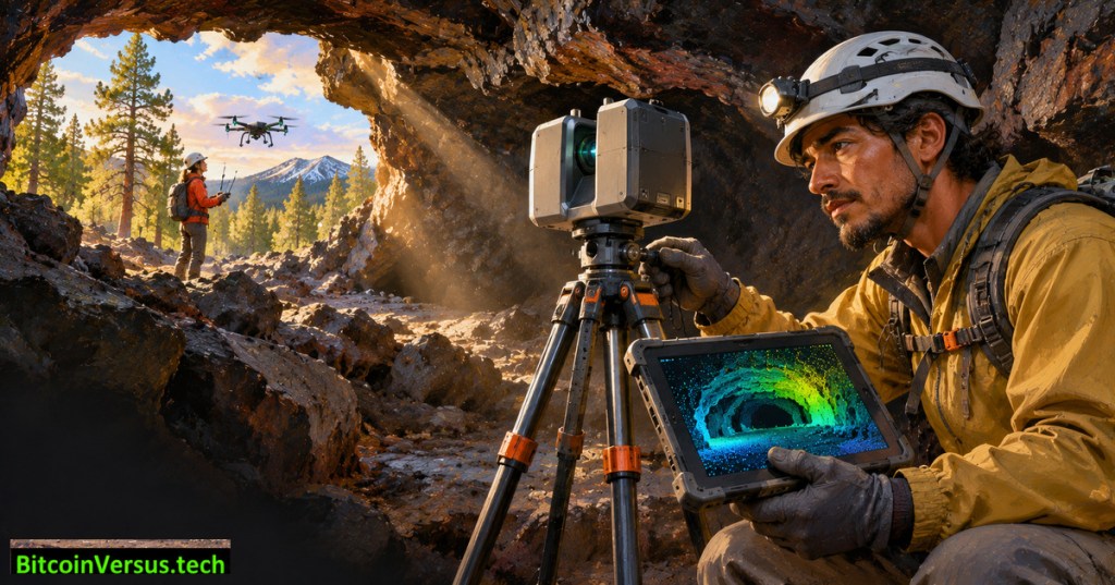
A volcanic tunnel in northern Arizona is giving NASA engineers a practical way to rehearse mapping the subsurface of the Moon and Mars. In a November 19, 2026 field report, NASA described a September campaign combining laser ranging, drone imagery and geological measurements at Lava River Cave near Flagstaff. The central problem is deceptively difficult: how do explorers align an accurate three-dimensional map of a tunnel with the terrain above when satellite positioning does not work underground?
NASA Science’s January 2026 documentary visits Hawaiian lava tubes, showing how field researchers investigate volcanic caverns as planetary analogs. The footage is from Hawaii, not the September Arizona survey. Watch the official NASA video.
Why a cave defeats familiar navigation tools
Lava River Cave runs for nearly a mile beneath Coconino National Forest. The tunnel formed when the exterior of a molten lava flow hardened while hotter material drained through the interior. Rock now blocks global navigation satellite signals, and iron-rich volcanic material can distort magnetic compass headings. Researchers therefore need geometry, overlapping measurements and reliable reference points, rather than assuming a phone-style map will locate every passage.
NASA’s Goddard Instrument Field Team operated lidar sensors inside the cave and captured dozens of scans around and through its entrance. Lidar measures distance using the travel time of reflected laser light, creating collections of three-dimensional points. Engineers can register overlapping scans into a common coordinate system, then link the underground point cloud with drone imagery of the surrounding forest. The entrance is the crucial connection between two otherwise difficult-to-align maps.
The experiment goes beyond pretty 3D images
Scientists also sampled temperature and humidity at dozens of places along the tunnel and measured wall hardness every few yards. Those readings help associate rock conditions with geometry, environmental gradients and candidate sampling areas. NASA has not claimed that the new survey alone proves a lunar cave safe for astronauts; it is a terrestrial method test, and its measurements and final 3D reconstruction remain subject to analysis.
The agency has shared an earlier Lava River Cave lidar fly-through through its technical-reports library, dated March 2026. That archival visualization is useful background but must not be mislabeled as a finished product from the September field campaign.
The European Space Agency’s official exploration animation examines methods for investigating lunar caves. Conceptual mission footage, not a deployed lunar robot or results from NASA’s Arizona campaign. ESA source and original YouTube embed.
Crater radar and lunar lighting were tested nearby
The expedition also worked around Meteor Crater, a roughly 4,000-foot-wide impact feature formed about 50,000 years ago. Teams used ground-penetrating radar and seismic sensors to trace buried ejecta beyond the visible rim. Researchers struck the ground near detector lines, then studied returning waves for clues about subsurface layers. The goal was to improve interpretation of similar impact deposits on the Moon, not to claim that every hidden layer had already been mapped.
At Cinder Lake Crater Field, another team evaluated how people perceive rock colors under lighting meant to resemble lunar south-pole conditions. Other scientists examined gas bubbles preserved in volcanic rock and the weathering of ancient ash deposits. Each activity tests an engineering or scientific uncertainty that an orbital photograph alone cannot resolve.
The connection to future space robotics
Earlier BitcoinVersus.Tech reporting has explored NASA’s planned lava-tube and ice experiments, autonomous planetary science robots, hazard-aware landing technology, and engineering challenges facing lunar landers. A robot descending into a cave would need comparable mapping and positioning abilities, plus reliable communication, power and a route back out.
The next useful milestone is a validated reconstruction showing how precisely NASA’s subterranean scans align with the surface survey, with documented uncertainty and repeatability. No lunar deployment date or field-tested autonomous cave rover was established by the November report. Field measurements made on Earth are essential groundwork, but they remain distinct from a demonstrated mission on another world.
Sources: NASA Goddard’s November 19 field report; NASA technical library’s earlier cave fly-through; NASA’s separate subsurface seismic research. Illustrations and archival videos are identified as contextual rather than September mission footage.
We volunteer daily to ensure the credibility of the information on this platform is Verifiably True. If you would like to support to help further secure the integrity of our research initiative, please scan the QR code below.



Leave a Reply