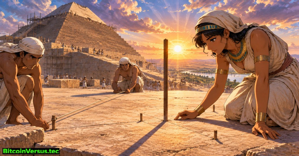
OSHE.008 examines a remarkable surveying achievement: the Great Pyramid of Khufu was laid out almost exactly along Earth’s north–south and east–west directions. A monument roughly 230 meters across needs consistent reference lines before most stone blocks are placed. Following OSHE.007 on moving limestone to Giza, the lesson examines how builders could establish a dependable orientation without modern instruments.
Key Learning Objectives
- Differentiate true north, magnetic north, cardinal alignment, and survey uncertainty.
- Explain proposed solar-shadow and stellar observations without presenting hypotheses as proven techniques.
- Show how a baseline, right angles, and diagonal checks establish a square footprint.
- Calculate a small angular error as an illustrative lateral offset, then interpret its limitations.
What surviving stones tell surveyors
True north follows the geographical meridian toward Earth’s rotational pole. Magnetic north points toward the shifting magnetic pole. Neither a modern compass nor satellite positioning was necessary to observe the sky. Researchers measuring surviving casing-related traces report orientation differences of only a few arcminutes; one arcminute equals one-sixtieth of a degree. Glen Dash’s survey research summarizes an error under four arcminutes. Modern teams use measured foundations and original casing evidence, not just eroded outer faces; the Ancient Egypt Research Associates survey program documents that work.
Solar shadows versus northern stars
Solar-shadow hypothesis: a gnomon is a rod casting a movable shadow. On a properly leveled surface, observers could mark successive shadow-tip positions. Around an equinox, carefully interpreted observations may help establish an east–west direction; a perpendicular line defines north–south. Dash tested an equinoctial-shadow method and found a plausible explanation for the alignment error. Weather, timing, rod placement, and imperfect measurements affect results. Demonstrating feasibility does not establish that Khufu’s workers used the method.
Stellar hypothesis: observers could watch circumpolar stars and transfer the inferred meridian to ground markers. Astronomer Kate Spence proposed a simultaneous transit of two northern stars. Stellar techniques depend on accurate sighting and the changing orientation of the celestial pole across centuries. Smithsonian’s account describes astronomy as important to pyramid orientation, but surviving records do not uniquely identify an original surveying procedure.
Turn a north–south line into four accurate sides
A baseline provides a reference direction. Surveyors can construct a perpendicular east–west axis, repeat the desired side lengths, and check corner geometry. In a classroom, sides of 3, 4, and 5 units produce a right angle: 3² + 4² = 5². A square with side L has diagonals of length L√2. Equal diagonals alone do not prove an arbitrary quadrilateral is square; consistent side lengths and right angles also matter. Rope geometry illustrates mathematical possibilities, not proof of historical tools. Compare the transition from Meidum to Sneferu’s Bent Pyramid and the Red Pyramid.
How far does an error of three arcminutes reach?
Worked example: three arcminutes equals 3/60 = 0.05°. Across an assumed 230-meter reference line, the lateral offset from an ideal meridian is 230 × tan(0.05°) ≈ 0.20 m, or about 20 centimeters. The number illustrates angular precision; it is not an observed misplaced pyramid corner. Archaeologists instead fit lines to multiple preserved points and assess measurement uncertainty. PBS NOVA’s “Decoding the Great Pyramid” follows Dash’s field survey and proposed shadow experiment.
Practice questions and answers
Question: What is the diagonal of a square foundation five meters wide? Answer: 5√2 ≈ 7.07 meters. Question: Does a small azimuth error prove an equinox-shadow method? Answer: No; several proposals are consistent with comparable accuracy. Question: Does the calculated 20-centimeter offset represent an actual defect? Answer: No; it depends on an assumed angle and distance.
Lesson conclusion: pyramid alignment combines astronomy, measurement, geometry, and construction control. Preserved evidence reveals remarkable precision, while the exact ancient technique remains disputed. The cover illustration is a fictional reconstruction rather than evidence of particular workers or tools.
We volunteer daily to ensure the credibility of the information on the platform is Verifiably True. If you would like to support to help further secure the integrity of our research initiative, please scan the QR code below.



Leave a Reply